Weather and sea
Choose a point on the map to view a 7- or 14-day hourly forecast. BayPilot retrieves Open‑Meteo Best Match data for those coordinates: temperature, wind and gusts, wind direction, precipitation, precipitation probability and MSL pressure. Best Match is not one fixed global model — depending on the region, Open‑Meteo automatically selects the highest-resolution model available, for example from the ECMWF, DWD ICON, NOAA GFS/HRRR, Météo‑France ARPEGE/AROME families or a local weather service. The map layer and hourly table are synchronised to the same forecast hour.
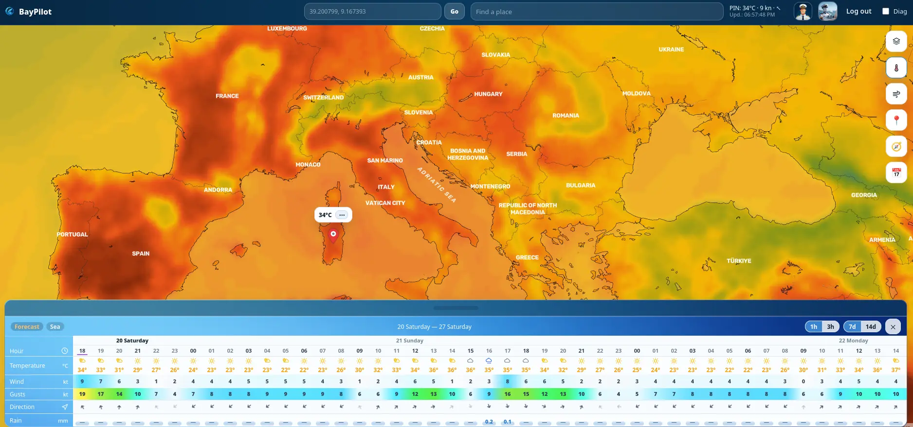
Map layers
air-temperature distribution
wind speed and direction
rain, snow and precipitation probability
forecast dBZ reflectivity and precipitation in mm/h
MSL pressure and isobars
Point forecast
The Weather table shows hours, temperature, wind, gusts, direction and precipitation. Switch between 1- or 3-hour steps and 7- or 14-day ranges, subject to available data.
Sea tab
For the selected point it shows water temperature, sea level, wave height, wave direction and wave period. Wave forecasts use the ECMWF WAM model.
How the forecast is selected
For the atmospheric forecast, BayPilot does not force one model worldwide, so Open‑Meteo Best Match selects the best model available for the chosen location. Wind direction is additionally retrieved from GFS Global, and MapTiler's forecast Radar layer also uses GFS. In the Sea tab, wave height, direction and period come from ECMWF WAM; sea-surface temperature and sea level use Open‑Meteo's best-matched marine data.
Forecasts and weather layers require an internet connection. They are supporting data and should be compared with official warnings and local conditions.