BayPilot — voyage planning, maps and weather in one place
BayPilot is an app for sailors and motorboat users that helps plan routes, check weather conditions and use a marine map with practical layers. In one place you can find navigation marks, isobaths, depths, ports, marinas, anchorages, fuel stations and other places that matter during a voyage.
Navigation map and sea marks
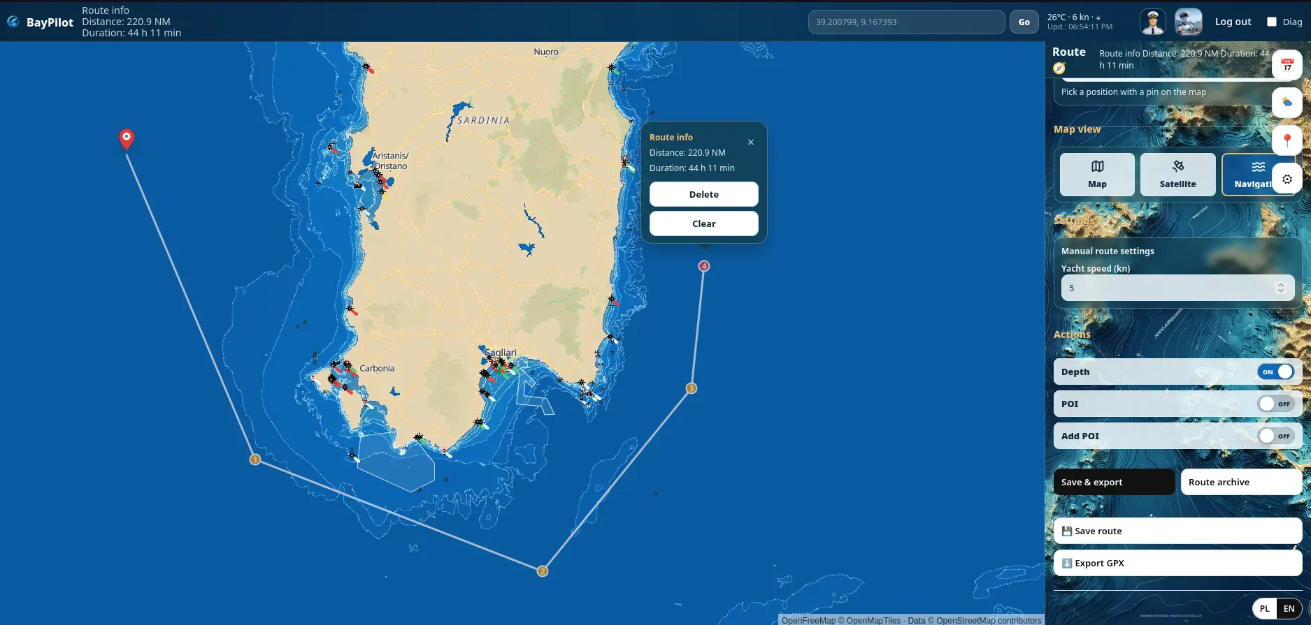
BayPilot is a web app and Android app for planning sailing routes and preparing a voyage before departure. In one place you can plan a route, check distance, estimated travel time, weather forecast, map layers, sea marks, isobaths and bathymetry.
The app was created as a practical planner for sailors, motorboat users and people preparing coastal voyages. BayPilot helps analyse a route, inspect the surroundings of ports, marinas, anchorages and fairways, and compare information from different map layers.
In BayPilot you can use the navigation layer, which shows useful information during voyage planning: sea marks, navigation aids, buoys, lights, ports, marinas, anchorages and other points relevant to navigation. Sea marks are available globally, so the app can be used to prepare voyages across many waters around the world.
The app also shows isobaths and a bathymetry layer, which help with an initial assessment of depths, shallow areas, approaches to bays, ports and anchorages. Bathymetry is especially useful when planning a route, choosing a stopover and reviewing areas where depth needs attention.
The bathymetry layer currently covers mainly European waters and selected areas, and its coverage may be expanded. Map and bathymetry data are intended as supporting planning information and should always be compared with official nautical charts, notices to mariners and the skipper's own assessment.
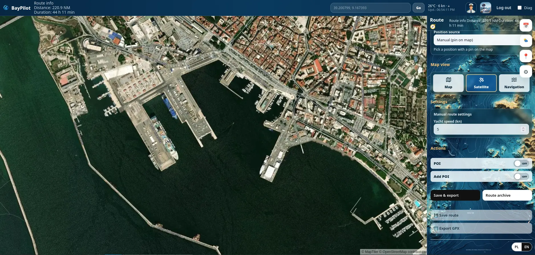
Satellite view and map layers
Switch the map between the classic map, satellite imagery and navigation layer. This helps you better assess the shoreline, marina entrances, bays, anchorages and the surroundings of the place you are sailing to.
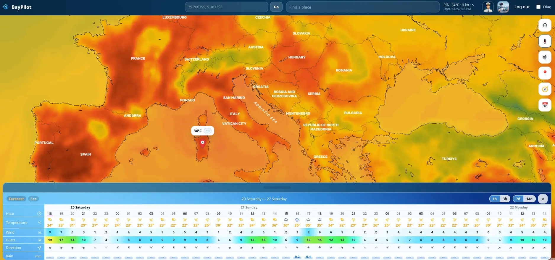
Weather, wind and temperature
Check the weather forecast directly on the map. BayPilot shows wind, temperature, rain and marine data where available. After placing a point on the map, you can quickly see the forecast for that specific location.
Offline maps and Android
BayPilot works in the browser and on Android devices. The app can also be used offline after preparing the data needed for a voyage. This makes route planning and access to saved information convenient even when internet access on the water is limited.
BayPilot was designed as a route planning tool and support for voyage preparation. The app does not replace official nautical charts, certified navigation systems, notices to mariners or decisions made by the person in command of the vessel.
Data shown in the app may differ from current conditions on the water, and maps may contain errors or omissions. Before a voyage, always check current navigation information, weather information and local restrictions.
Support and feedback
Have a question, an idea, or found an issue in BayPilot? Feel free to contact us or create a new post in the Problems and Requests sections.
Every report, suggestion, and piece of feedback helps us improve BayPilot and make the app better for sailors and motorboat users.